
Certified Leak Analysis of Drone Thermal Data
Level 3 analysis of drone thermal data for underground water leaks, with each candidate location classified in a certified report.
A drone can capture hundreds of thermal images over a buried main, an irrigation network or a pipeline corridor in a single session. Turning that imagery into a short, defensible list of places worth investigating is a different skill entirely, and it is the one Thermography Services (UK) provides to operators, network owners and consultancies.
We analyse drone thermal data captured by your own team or operator. Every thermogram is reviewed, each possible leak location is tested against the pipe's own baseline, and every candidate is classified, given a confidence, located and certified by our Level 3 thermographer, ready for ground-based confirmation.
Your operator flies the route; we analyse the data and certify every leak candidate.
Drone thermal surveys of buried water pipes are now common, and the capture is often done well. The harder part comes afterwards: deciding which of several hundred images show something worth investigating, and saying so in a form that a network owner, an insurer or a contractor can rely on.
That is the service on this page. You send us the radiometric thermal files and matching visual images from the survey, with the pipe route and what is known about the network. Our Level 3 thermographer checks the delivery first, so any gap in the data is declared rather than hidden. Every thermogram is then screened in a triage pass, and the locations that pass forward are analysed in detail. Each one is measured against a baseline taken on a normal section of the same pipe in the same image, because a pipe’s temperature changes along its route. A location becomes a candidate only when it departs from that baseline and the pattern itself is out of place: spreading to one side, shifting off the pipe line, widening, or rising and falling along the run. Temperature alone is never enough.
Anything else that could produce the same signature is checked against the visual imagery, from access covers and vegetation to vehicles, vents and surface repairs. What remains is classified as a Confirmed, Possible or Unlikely Candidate, with a stated confidence, and set out with its location, its evidence and the ground verification it calls for. Every report is written and certified by our Level 3 thermographer.
Level 3 analysis of drone thermal data for underground water leaks, with each candidate location classified in a certified report.
Page Subjects
drone thermal leak detection analysis, Level 3 leak detection report, aerial thermography leak analysis, drone thermal data analysis service, certified analysis of drone thermal imagery


Page Tags
drone thermal data, leak detection analysis, aerial thermography, underground water leaks, Level 3 thermographer, certified report
Request a Leak Analysis Quotation
Every dataset is different, so every leak analysis is scoped to the survey behind it. Tell us about the network and the pipe route, when and how the data was captured, the drone and camera used and roughly how many images there are, and we will come back with a clear proposal and a quotation for the work. If the survey has not been flown yet, we can quote for the data collection protocol as well.
Why drone data needs analysis
Reading Leaks in Thermal Imagery
A buried pipe cannot be seen from the air. What a thermal camera records is the surface above it, and how that surface holds and releases heat compared with the ground around it.
Water escaping from a pipe changes that behaviour. Wet ground stores and gives up heat differently from dry ground, and the water itself may be warmer or cooler than its surroundings at the time of capture. Depending on the season, the ground and the pipe, a leak can therefore show as a warm plume or a cool one, and in porous ground a wetted zone at depth may reach the surface as cooling rather than warmth. There is no single colour to look for, which is why the pattern matters more than the peak temperature.
Plenty of other things change surface temperature too. Access covers and chambers, recent surface repairs, roadside vegetation, irrigation and washdown water, vents, parked or departed vehicles and other buried services can all leave signatures that look, at first glance, like escaping water.
Separating the two is the real work. Each possible location is judged against how similar features read elsewhere in the same dataset, checked against the matching visual image and compared across overlapping frames. A signature that holds its place and its shape from one frame to the next carries more weight than one that does not.
The result is a short, graded list instead of hundreds of images. A Confirmed Candidate meets the full evidence criteria. A Possible Candidate meets them in part, or carries a competing explanation that thermal imaging alone cannot resolve. An Unlikely Candidate is reported only where you would expect an area of interest to be shown as examined, such as a junction or a crossing.
None of these is a confirmed leak. Each is a location for ground-based confirmation by a leak detection contractor, using acoustic or other methods, before anyone excavates. What the analysis saves is the search.
Related Water Leak Detection Services
What to send, and when
Before and After the Flight
The analysis can only be as good as the data. The essentials are the native radiometric thermal files with their original file names, never screenshots or exported pictures, the matching visual images, the flight log, a record of the weather during capture and the pipe route as you hold it, with its source.
Timing matters as much as the camera. Capture before dawn in settled, dry weather usually gives the clearest contrast, and rain in the days beforehand can mask a leak altogether. If the survey has not yet been flown, our Level 3 thermographer can write a data collection protocol for the route first, so your operator knows when to fly, what to capture and what to record.
Data already captured can still be analysed, even if it was flown without a protocol. Most gaps are declared as limitations in the report rather than treated as a reason to turn the work away, and you are told at the start what the data can and cannot support, so the findings carry no more weight than the evidence allows.
Need the survey flown as well? Drone Media Imaging captures aerial thermal data of buried mains and pipelines, and will provide a quotation for the flight. The certified Level 3 analysis and report then follow here.
Case Study
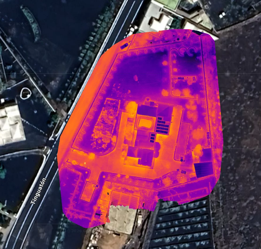
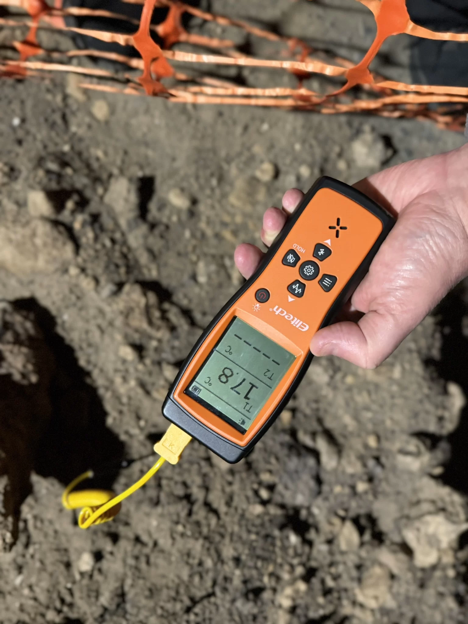
Pipeline Corridor Leak Analysis in Lanzarote
Certified Level 3 analysis of pre-dawn aerial thermal data captured by SKYNOX Drones SL along a 517 m municipal water pipeline corridor in Tías, Lanzarote, where the main shares its trench with other services. From about 125 captures, 42 thermograms were selected and classified in two passes, against an ambient road reference and a local pipe baseline. Six locations across four clusters met the full criteria as Confirmed Candidates. A further 22 were classed as Possible Candidates, where roadside vegetation offered a competing explanation.
Standards and Governance
Thermographic analysis and reporting are carried out by a Thermography Services (UK) ITC Level III Certified Master Thermographer (Infrared Training Centre; Certification #205722059), practising in accordance with the frameworks of ISO 18436-7:2014, ASNT SNT-TC-1A and ANSI/ASNT CP-105, and BINDT CMGEN Appendix B (UK training governance). No published international, European or national standard defines a method or acceptance criteria for airborne infrared thermographic detection of leaks from buried pressurised water mains. The analysis was therefore carried out to a documented procedure, aligned with the principles of ISO 10880:2017 and BS EN 16714-1:2016 for passive infrared thermography. All anomalies reported are candidate locations requiring ground-based confirmation.
Drone Thermal Leak Detection Analysis
What a Level 3 leak detection report contains
Drone thermal leak detection analysis turns a set of aerial thermal images into evidence that a network owner, an insurer or a leak detection contractor can act on. A Level 3 leak detection report sets out the survey scope and the conditions on the day, the working assumptions about the network and the limitations of the data, a findings table with each candidate’s classification, confidence and location, and the ground verification recommended for each one. Behind the findings sit the methodology, the environmental record of the capture and an appendix of annotated thermogram pages, one candidate location per page. Where the camera recorded GPS for each image, every candidate is given coordinates; where it did not, locations are given by zone along the surveyed route, with the visual image for orientation.
A leak detection report from a drone survey is only as useful as its reasoning is visible. Every classification in our reports can be traced to the measurements on its page: the reference taken on clean ground, the baseline taken on the pipe, the size of the departure, and the shape of the pattern across and along the pipe. Alternative explanations that could not be excluded are declared beside the finding, never quietly removed. The report also states how many thermograms were reviewed, how many were analysed in detail and how many are reported, so the reader can see exactly how the short list was reached.
Third-party drone thermography analysis
Most of the data we analyse is captured by someone else, which is exactly what this service is built for. Third-party drone thermography analysis suits drone operators who capture well and want a certified result to hand to their client, water companies and estates with their own survey contractor, and consultancies investigating losses on a network. Certified analysis of drone thermal imagery covers the analysis and its interpretation; the capture itself, the survey scope and its completeness remain with the party that carried them out, and the report says so. The imagery and survey data remain with whoever captured them, and the findings are yours.
Aerial thermography leak analysis works best when the method is fixed before the flight. Where it is not, the report records what was and was not available, from the weather record to the pressure state of the main, and qualifies the findings to match. A drone thermal data analysis service that hid those gaps would give you confidence the data cannot support.
Our thermal drone survey analysis serves clients in the UK and internationally. For clients working in another language, the English report can be issued with a translation support companion, with the English text taking precedence. Every report is written and certified by our Level 3 thermographer. Water entering buildings through roofs, walls and openings is a separate subject, covered by our Flat Roof and Water Ingress Surveys within building thermography.
Standards for Leak Thermography
What the standards cover
No published international, European or national standard defines a method or acceptance criteria for detecting leaks from buried water pipes by infrared thermography, from the air or from the ground. Standards written for solar PV and for building envelopes do not cover buried pipes, so neither is cited in leak work.
Our analysis follows a documented procedure aligned with the principles of ISO 10880:2017 and BS EN 16714-1:2016, the general principles standards for infrared thermographic testing, which set no leak criteria. ASTM D4788, which uses passive thermography to find defects beneath asphalt on concrete bridge decks, is the closest published precedent and is noted only as an analogue. Because no standard sets the rules, ours are written down and stated in every report, so each classification can be checked rather than taken on trust.
Request a Leak Analysis Quotation
Every dataset is different, so every leak analysis is scoped to the survey behind it. Tell us about the network and the pipe route, when and how the data was captured, the drone and camera used and roughly how many images there are, and we will come back with a clear proposal and a quotation for the work. If the survey has not been flown yet, we can quote for the data collection protocol as well.


